The XYL and I enjoy taking trips over to Michigan’s upper peninsula especially during the late summer months, in fact it is our favorite time to enjoy Michigan’s U.P. during the year. Late summer is a great time to visit as the black flies and other bugs seem to be tame and with children back in school many of the tourist stops are not that busy. While the trip was not completely radio orientated, with how spectacular of scenery I figured I had to share some highlight pictures from the trip.
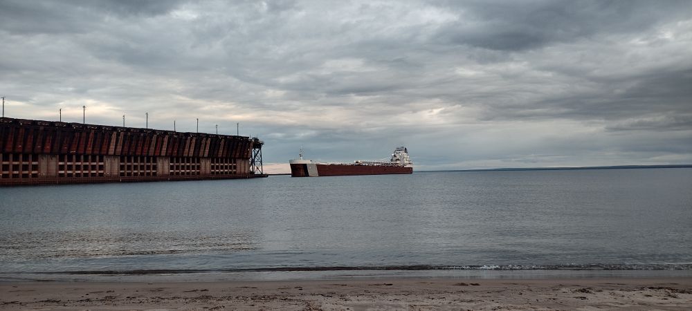
Marquette is one of the larger and more modern cities in the U.P. We had stopped here for other trips in the past. This year we made a few discoveries for areas we had not previously visited. For past visits to the downtown area the Lower Harbor Ore Dock draws many visitors, this larger imposing structure was formally used for transitioning ore from rail to the freighters of the great lakes. For this particular visit we discovered the upper Marquette Ore Dock located just north of town. This ore dock is active and in fact while we were visiting the beach we were able to see the Great Republic freighter work the docking process.
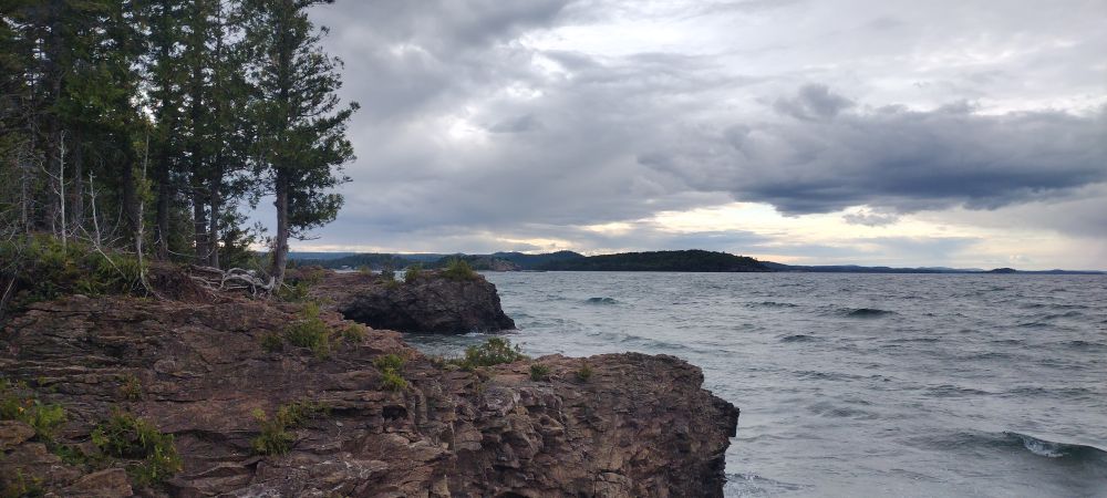
Just a short drive north of the Ore Dock we found Presque Isle Park this park is managed locally so unfortunately it was not a viable and official parks on the air location. While the park was just a short drive from modern Marquette the scenery from the circle drive that visitors can drive around the perimeter of the park were breath taking.
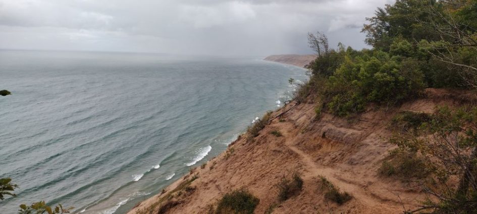
Further east of Marquette we made a stop in Grand Marais and visited the log slide over look trail which is part of the Pictured Rocks National Lakeshore park managed by the National Park Service. In the early pioneering days this area of land was used heavily for logging. As the loggers would cut down trees they needed an easy way to transport the trees. Workers would activity send logs down the dune of around 175 feet and into Lake Superior to be floated to a nearby saw mill.

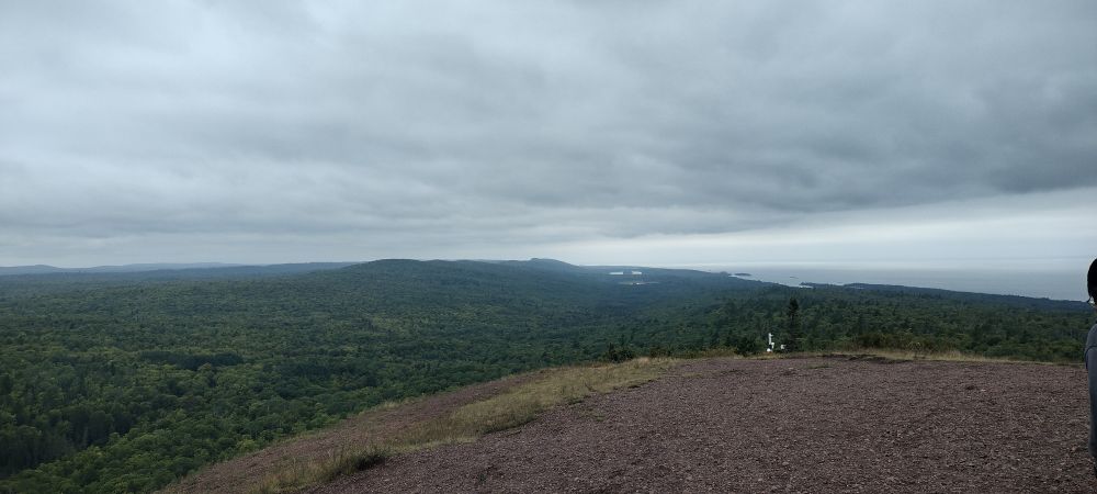
One of my favorite view points in the U.P. is from Brockway mountain located at the northern end of the Keweenaw Peninsula and located just south of Copper Harbor. Visitors can take Brockway Mountain Drive to the top and the view is breathtaking. With this location having an elevation of 726ft above the lake level below, from this vantage point you can visually see a 360 degree panorama of the Keweenaw Peninsula. From this height the large laker freighters appear to be the size of small toys. Given the impressive height of this location when we made this stop late in the day I had to pull out my portable HF setup and make a few contacts on 20m! Interestingly I was not able to get my vertical and loading coil to properly tune up on 40m. I wish I had my NanoVNA to troubleshoot further but I have a hunch the issue may have some something to due with the ground conductivity in this area.
Given the tough terrain and low population in the northern Keweenaw, many of the communities including Eagle Harbor and Copper Harbor have little to no cellular coverage and there are not many options for modern internet. There is a good amount of information written up about the cellular companies trying to get buy in to build additional towers at the Keweenaw Mountain Lodge over the past few years. While some see the connectivity as modernization others view the lack of cellular and high speed internet as a a get away.
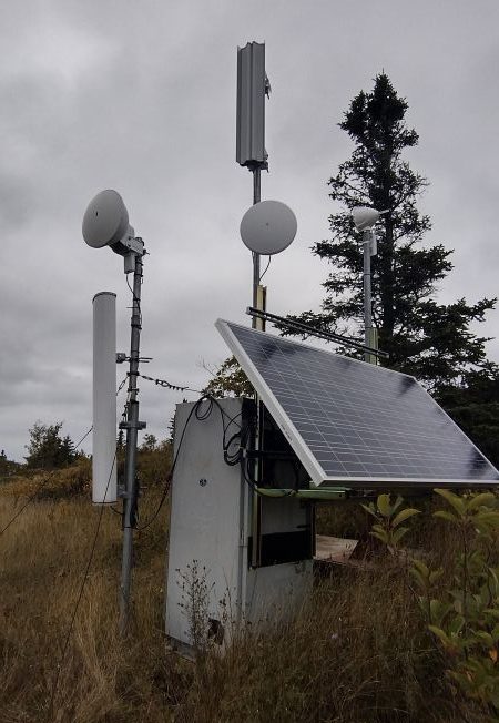
While on top of the Brockway Mountain I discovered a setup from one of the local WISPs, Pasty Net who operates solar powered relay for serving these under served communities. Even with the rise of Starlink a number of the local businesses in Copper Harbor are still using this local WISP. The setup seems to include a number of Ubiquity 60Ghz equipment. Its worth mentioning that the winter exposure that this setup sees is likely intense. I would not be surprised if someone has to regularly make the trek up the mountain by snowmobile to regularly clear the solar panel. I would be curious to see the failure rates of equipment this location has seen. I was also interested to find that one of the smaller antenna elements seems to be pointed toward Isle Royal. I’m curious if the island is being served by this node.
While on vacation I find it is always good motivation to active some parks for POTA. For this trip specifically we successfully activated four different parks:
- US-1486 – Baraga State Park
- US-3311 – Fork Wilkins State Park
- US-1548 – Twin Lakes State Park
- US-1534 – Porcupine Mountains State Park
In some of my next posts I plan to provide a trip report for my park activations.
As the busyness of summer starts to winddown I am looking forward to diving into some new projects and radio related activities as we head into the fall and winter. I am hoping to dive into the world of radio homebrewing and may dabble in Meshtastic.