I spent a recent trip in Michigan’s Upper Peninsula to enjoy the winter weather and some of ice formations in Munising, near Picture Rocks National Lakeshore and found some time on my hands for an activation. In past summers I have performed a few different activations from the U.P. and was eager to get another one in the log.
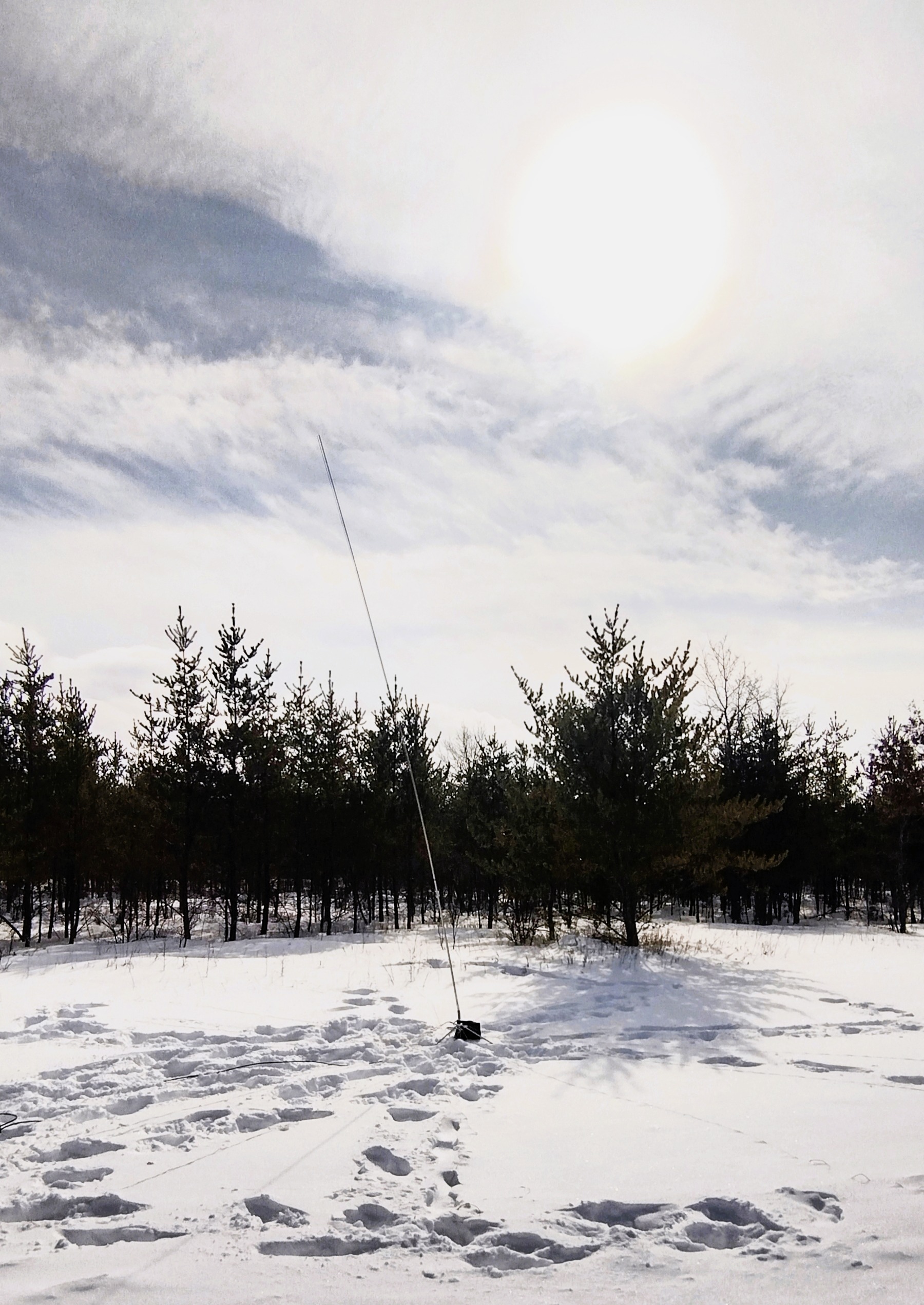
While I have been active in POTA during the past two summers, this year I have have been trying my hand at some winter activations. For a setup I don’t have a permanent HF mobile setup so I have been deploying my portable telescoping Chameleon antenna outside and running the coax through my window to a IC-7300 and laptop inside the warm car.
My first few winter activations were a bit frustrating and I learned quickly that the surface pro laptop I use for logging does not operate below freezing temperatures and will automatically shutdown in a short period of time. There is nothing more inconvenient than trying to work the pile up and having the laptop just quit on you!
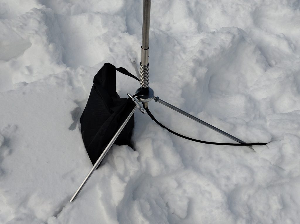
Another challenge I have had with winter operating is for keeping my vertical antenna and tripod from toppling over in the gusty wind. My solution for when I encountered this problem in the summer was to use some rope and tent stakes to guy the system to the ground. It is a little extra work to deploy but on windy days has served me well so far. In the winter months I have not had great success sinking the tent stakes into Michigans frozen ground.
For trips that I go on I try to do some research ahead of the trip on possible good locations to setup for my parks on the air activation. While the official parks on the air website, https://pota.app is helpful in identifying the general location of a park (as a literal dot), I have found that this site is not very helpful in showing the park boundaries especially when it comes to large parks. To help overcome this issue I have recently been using https://hammap.io/ to help me better determine where some of the nuances of a parks boarders maybe. I also use google maps satellite view to help me determine specially possible locations to setup.
For this specific activation, given that it was winter I knew in advance there would be hurdles to overcome. There are many areas of parks or in the national/state forest areas that are closed for the winter. While a park or state forest maybe open to the public, many access roads do not get the snow cleared from them. For this activation I had seven potential locations for the activation identified to scope out. Some of the locations I tagged ranged from hiking or cross country ski trail heads to the Hiawatha National Forrest Monument. Unfortunately out of the seven locations only two sites ended up being feasible. Many of the locations I identified initially were found to be impassable due to unplowed snow and the cross country ski trail heads were bustling with a bit more activity than I wanted.
The location that ended up working out was the Bay De Noc Grand Island National Recreation South Trailhead (45.931, -86.919). This trailhead is included in the vast area of the Hiawatha National Forrest US-4487. The Hiawatha National Forrest is located in Michigan’s Upper Peninsula and is separated into a section covering the eastern portion of the U.P. and a central portion of the U.P. The land mass is managed by the US Forestry service and covers a whopping 900,000 square acres. Being further south from Munising the snow in this area, while present, wasn’t quite as heavy as it was further north. I found that the drive just before the trailhead was plowed with a small area to park and a open corridor of cleared land, perfect for deploying an antenna and parking nearby.
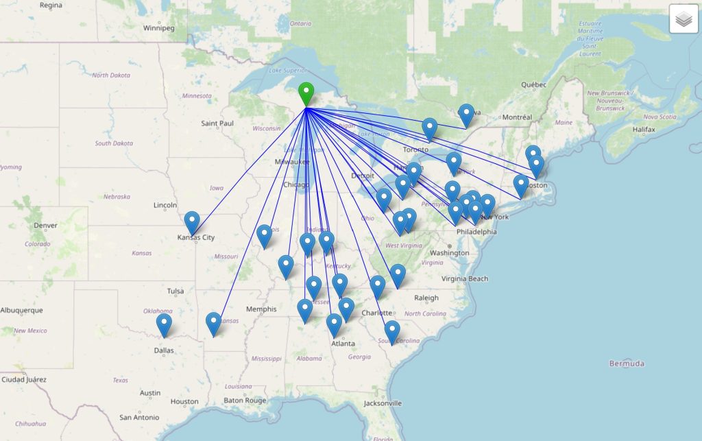
When I fired everything up I found that 20m was active but I was able to find an open frequency within a few minutes. Having spent a good amount of time searching for a location to setup cut me short on time but from my 35 minute activation I was able to make 34 contacts. Most of my contacts in the band seemed to be concentrated from the south east.
As an improvement to my portable setup I recently purchased a set of four weight bags as an alternative to my previous method of using ropes and tent stakes as guy wires. These bags are typically used for helping to hold down tripods for photography. While the wind wasn’t too violent during this activation but there was a steady breeze from time to time. As a bonus it seemed like a single weighted bag was sufficient for keeping the antenna from tipping. I am going to be plan to use this method in the future as it beats having to untangle extra ropes and set stakes into the ground.
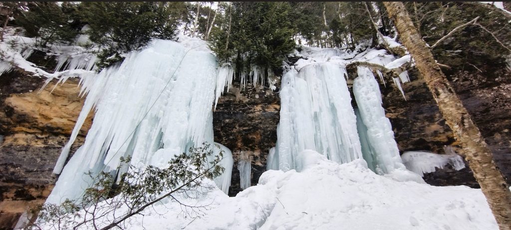
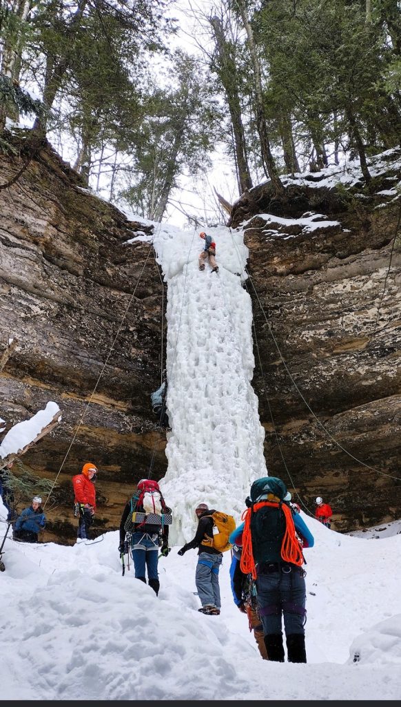
After the activation we packing up and paying a visit to Pictured Rocks National Lakeshore park and visiting some of the winter ice formations. I have included a few pictures from visiting Amphitheater and a formation named Dryer Hose that included a number of ice climbers.